Video: One of Many Creeks on the Property
The Land
HUNTING GAME
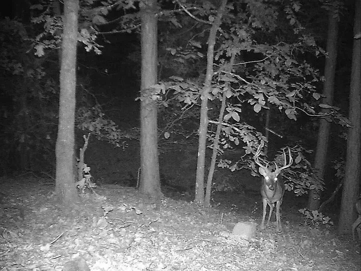
Whitetail Deer
Black Bear
Fox Coyote
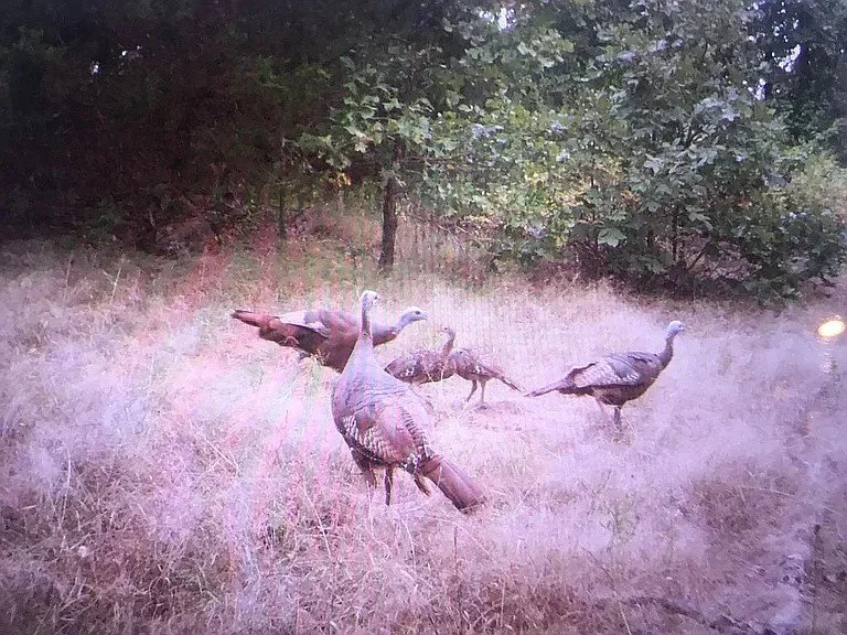
Wild Turkey
Squirrel & Rabbit
HOMESTEADING
Free Range Chicken Pasture w/ Electric Fence Large Capacity Chicken Coop Bones of 24’ x 26’ Hoop House/Greenhouse (needs repair)
Breaker Panel Generator-Ready (No Exterior Plug Installed)
Functional Wood Burning Stove
LOCATION
15 Minutes From Town Protected National Forest View
< 5mi from Jack Creek & Knoppers Ford Recreational Areas
< 2.5mi to National Forest Trail Entrance #39
EXTERIOR BUILDINGS
RV Overhang w/ Hookup
Large Barn w/ Electrical
Insulated Shop w/ Electrical
30+ Flock Chicken Coop w/ Quarantine Area
Wooden Storage Shed
LAND
Multiple Spring-fed Creeks
Mostly Wooded w/ 2 potential Food Plots
Creek-fed Drainage Area w/ Pond Potential
~20’ tall Deer Stand Overlooking Potential Food Plot
DEEDED ACCESS
Deeded Easement
Full Bulldozed Perimeter Trail w/Marked Boundaries
Interior Trails
Free Prescribed Burns Managed by Forestry Service*
*Due to close proximity to National Forest. Option to continue or cancel this service. Currently scheduled for Forestry Service to conduct burns every 3 years and manage bulldozed perimeter trail as a firebreak.
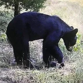
Spotted on Trail Cameras
LIVE THE NATURAL STATE DREAM
There’s nothing like owning 80 acres in the heart of Arkansas. Surrounded by rich hardwoods, marked trails, and the call of wild game, this land offers more than space—it delivers a lifestyle. Whether you hunt deer, turkey, or simply seek peace under the pines, this is your front-row seat to the best of the Natural State.
Above Videos: Enjoy Some Wildlife We Captured on Our Trail Cameras on the Property
Aerial Photography & Trails
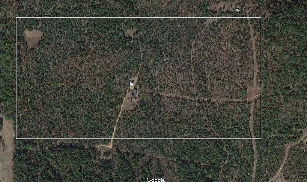
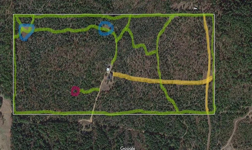
Above Images: Aerial Photo of Property (c. 2020). White Rectangle Represents Estimated Boundaries (Exact Boundaries are Surveyed and Marked).
Yellow Highlights Represent Electrical Easement that is 20’ Wide & Bulldozed (No Private Easement Traffic)
Green Highlights Represent Trails
Pink Circle Represents Water Drainage Ditch with Pond Potential
Blue Circles Represent Potential Food Plots, Top Left Blue Circle is Location of 20’ Tall Deer Blind.
Note: Images and highlights represent estimated locations
Overcast Ouachita Mountain views of the National Forest from the living room during the snow storm in 2021